
![[aggregator] downloaded image for imported item #83155](https://newsview.top/wp-content/uploads/2026/05/ANTARCTICA-WEDDELL-SEA-NEW-ISLAND-FOUND-DISCOVERY-1-1024x576.jpeg "Explorers discover unknown Antarctic island long marked as 'danger zone' on maps")
This post was originally published on this site.
Researchersrecently discoveredthat a long-misidentified Antarctic “danger zone” was actually an island — and have now mapped it for the first time.
The discovery was announced in an April press release from the Alfred Wegener Institute (AWI), a German polar research center based in Bremerhaven.
The island is located in the northwestern Weddell Sea, and was spotted during an expedition aboard the AWI’s icebreaker Polarstern.
CRUISE SHIP TRAPPED IN HEAVY SEA ICE IS RESCUED BY US COAST GUARD VESSEL
Researchers were originally studying therapid decline of sea icein the region when harsh weather forced them to pause.
They took shelter on Joinville Island to avoidthe wind and waves— where they later spotted the previously unidentified island.
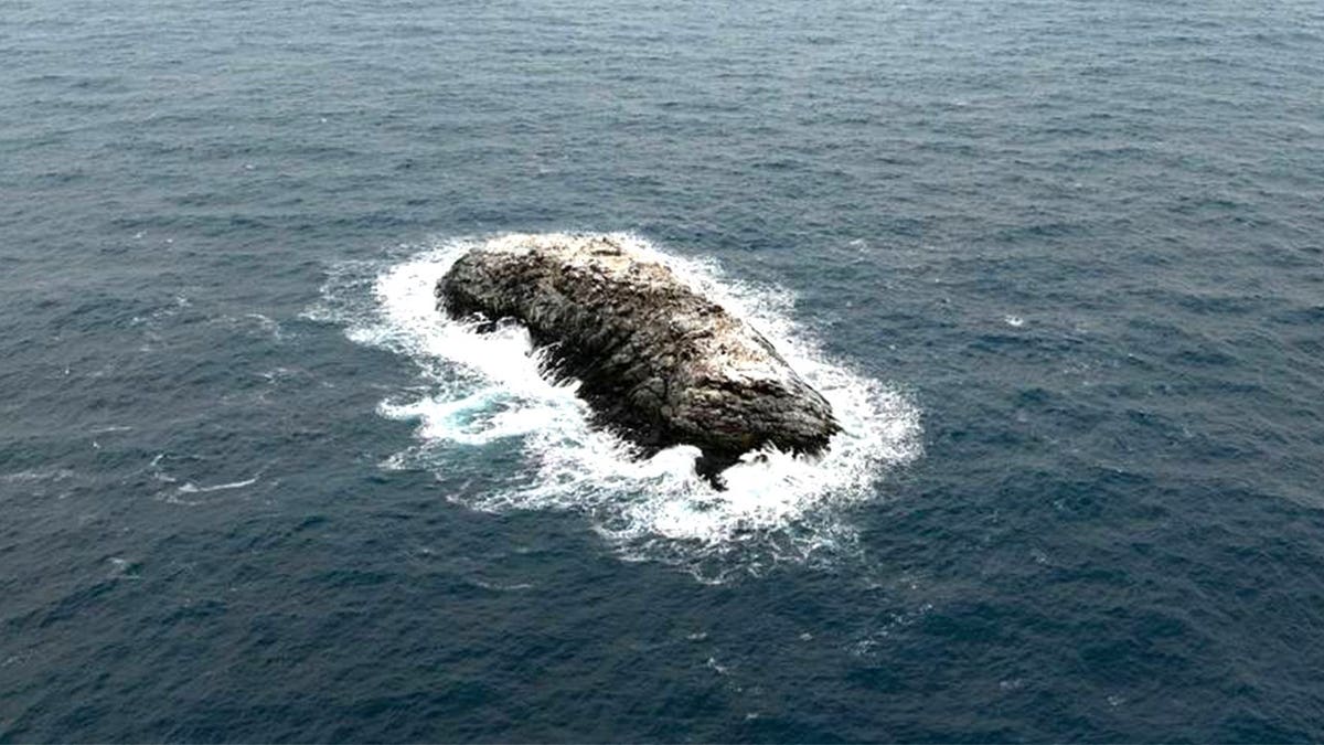
A polar research team confirmed the existence of a small rocky island after spotting what first appeared to be a dirty iceberg.(Alfred Wegener Institute/Christian Haas)
“On our route, the nautical chart showed an area with unexplored dangers to navigation, but it wasn’t clear what it was or where the information came from,” Simon Dreutter, a bathymetry data engineer at AWI, said in a statement.
MYSTERY SOLVED?RESEARCHER CHALLENGES LONG-HELD THEORY OF WHAT SANK SHACKLETON’S ENDURANCE IN ANTARCTIC ICE
After examining the available coastline records, Dreutter looked out the window and saw “an ‘iceberg’ that looked kind of dirty.”
He recalled that “on closer inspection, we realized that it was probably rock.”
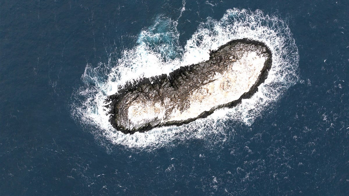
Scientists used drone imaging and echo sounding technology to survey the small Antarctic island, documenting its size and confirming it rises more than 50 feet above the surrounding water.(Alfred Wegener Institute/Christian Haas)
“We then changed course and headed in that direction, and it became increasingly clear that we had an island in front of us!”
Researchers approached and circumnavigated the island,surveying the seabedwith an echo sounder and drone imaging — marking the first time the region had been surveyed and recorded.
The island is roughly 426 feet long and about 164 feet wide.Officials say it “protrudes about 16 meters (52 feet) out of the water.”
The “discovery of an island is a rare and exciting event.”
Officials are still unclear why the island was marked as a danger zone — noting it resembles surrounding icebergs from an aerial view.
The reason may be tied to the number of uncharted shoals on the seafloor, said a representative from the institute.
�hummocky mounds in which water depths can change abruptly over very short distances.”
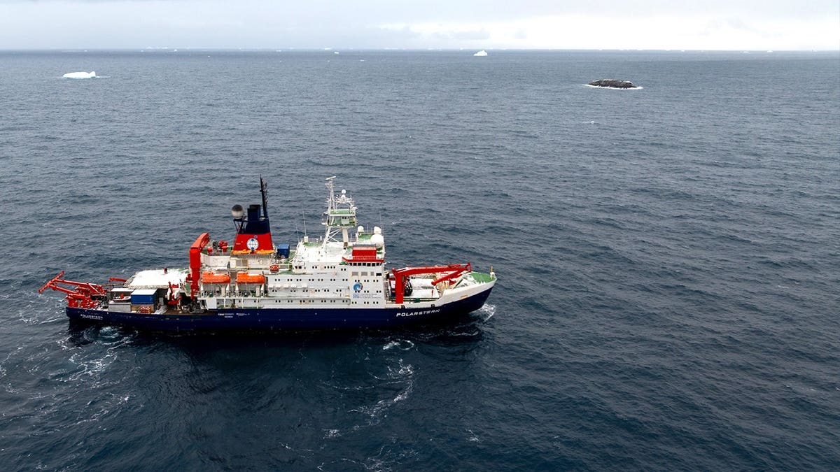
The Polarstern research vessel served as the base for scientists who confirmed and mapped a newly identified Antarctic island during an expedition in harsh weather conditions.(Alfred Wegener Institute/Christian Haas)
“Most areas are modeled from satellite data in low resolution,” the AWI representative said.“Therefore, many areas, especially inshore and nearshore, can be considered white spots or gaps in the map.In consequence, also nautical charts only have a patchy data coverage.”
onelink.me/xLDS?pid=AppArticleLink&af_web_dp=https%3A%2F%2Fwww.
Since the island has not yet been officially named, it will now go through the formal naming process, with a proposal being submitted to the Scientific Committee on Antarctic Research (SCAR) for consideration.
The age of exploration may seem over, but officials say less than a quarter of theWeddell Seais fully charted — and there’s plenty more to find.
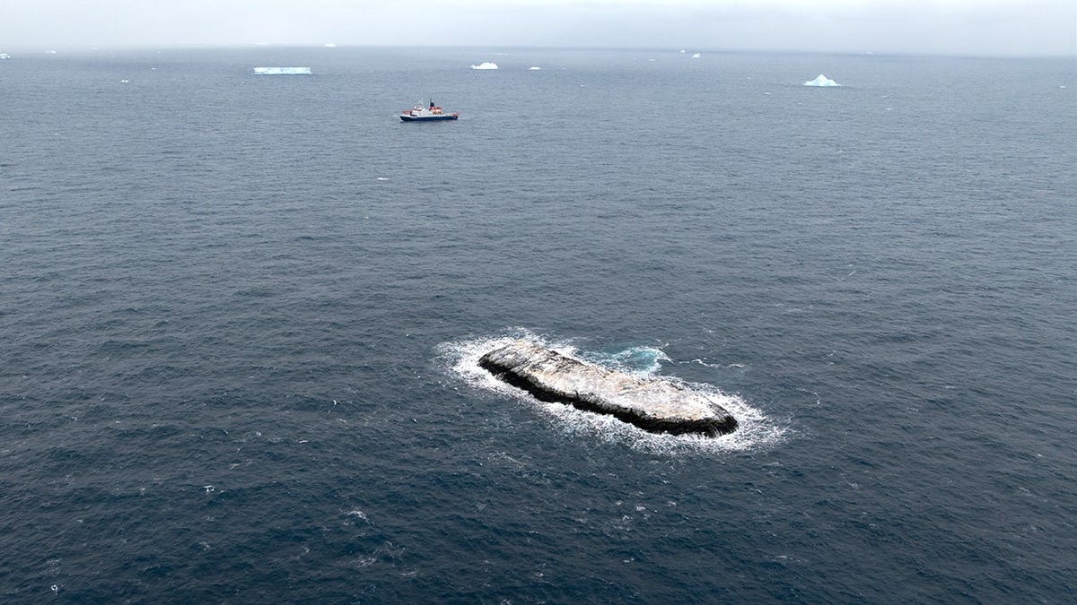
Researchers explained that many inshore and nearshore areas in Antarctica remain poorly charted, leaving gaps in nautical maps that can obscure features like shoals or seafloor mounds.(Alfred Wegener Institute/Christian Haas)
“Since satellite observation, even in theremote areas of Antarctica, the discovery of an island is a rare and exciting event,” the spokesperson said.
TEST YOURSELF WITH OUR LATEST LIFESTYLE QUIZ
“But with only about a quarter of the Antarctic water charted, there is still a good scope for discovering landforms on the seabed.”
![[aggregator] downloaded image for imported item #62427](https://newsview.top/wp-content/uploads/2026/04/marriott-hotel-niagara-falls-fox-news-001-1024x576.jpeg "Some Marriott guests tout Coke's new move as 'best ever' while Pepsi loyalists push back")
![[aggregator] downloaded image for imported item #62420](https://newsview.top/wp-content/uploads/2026/04/coast-guard-rescue-family-1024x576.jpeg "Coast Guard rescues family stranded for days in Pacific after boat failure sets them adrift")
![[aggregator] downloaded image for imported item #62412](https://newsview.top/wp-content/uploads/2026/04/woman-gives-birth-midair-sparks-citizenship-debate-1024x576.jpeg "Child born during international flight to US sparks heated debate about citizenship, legal identity")
![[aggregator] downloaded image for imported item #62668](https://newsview.top/wp-content/uploads/2026/04/ancient-egypt-scrolls-found-archaeology-history-discovery-1-1024x576.jpg "Valuable discovery in Egypt reveals 3,000-year-old scrolls with secret messages still unread")